2008
I managed the preparation of the request of the permit for discharge in the public wastewater system of a large industrial installation.
2008
I managed the preparation of the request of the permit for discharge in the public wastewater system of a large industrial installation.
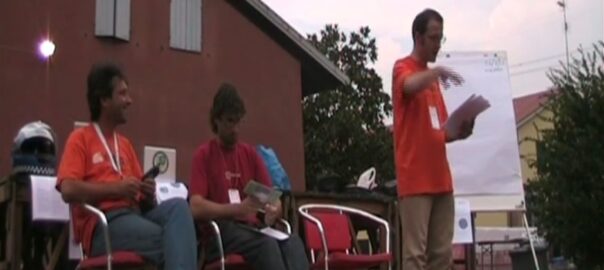
With a double-feature talk on m(‘)appare Maremma and BuioMetria Partecipativa – with Andrea Giacomelli and Francesco Giubbilini.
In August 2008 I coordinated and promoted the Summer Campaign for GFOSS.it, the Italian OSGEO Chapter.
The operation implied our presence with a stand at Festambiente, close to Grosseto, Southern Tuscany, one of the largest festivals run by environmental activists in Italy.
To manage shifts (ten days, each day from 4.30 PM to midnight), we set up a team of eight volunteers, coming from various parts of Italy. Our base camp was in Tatti.
Those who were not assigned to a shift, did whatever they wanted, typically coding or mapping in the fields.
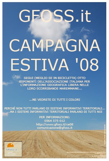
The image used for the flyer of the Summer Campaign plays with the double meaning of the word “campagna” in Italian, which stands both for “campaign” and “countryside”. The photo was taken by me South of Scansano, again in Southern Tuscany, a couple of years earlier.
A talk which I proposed at the Third Creative Commons Festival in Vigheffio (Parma, Italy) . Under the video, the abstract of the talk, which I read and commented as an introduction. Unfortunately the recording is incomplete.
TO BE TRANSLATED – please write to micalosapevo@pibinko.org if you need this translation.
Creative Commons e informazione geografica: una relazione in via di sviluppo.
Nell’ambito della produzione di contenuti e di servizi, l’informazione geografica occupa un ruolo chiave.
E’ evidente anche al grande pubblico che moltissime pubblicazioni (quale che sia il supporto) utilizzano mappe e rappresentazioni spaziali.
Non è sempre evidente al grande pubblico, ma lo è per per moltissimi tecnici ed esperti, che servizi basati su riferimenti e relazioni spaziali costituiscono un elemento di supporto decisionale imprescindibile (si pensi ai ragionamenti necessari per l’ubicazione ottimale di
una biblioteca o un servizio medico, come di un’attività commerciale).
Quello che è tuttora in via di sviluppo è il consenso su una licenza con cui veicolare questi dati.
Una parte rilevante di “informazione geografica” viene acquisita da enti pubblici e attraverso risorse pubbliche, ma viene attualmente ridistruibuita secondo licenze e modalità estremamente eterogenee e non sempre in….[OMISSIS]
Esistono progetti, a livello locale e globale, in cui a database geografici sono state applicate le CC. Nel giro di pochi anni, se non mesi, è emerso il fatto che le CC applicate al dato geografico sono forse “il migliore dei mondi possibili” attualmente, ma pongono anche alcuni interrogativi nel contesto europeo e italiano in particolare.
L’incontro/dibattito vuole portare avanti il ragionamento, che dall’autunno 2007 è in atto a livello nazionale fra esponenti delle comunità legate all’informazione geografica libera, esponenti della comunità CC (e Copyleft), e utenti.
L’incontro avviene in una fase estremamente vitale della discussione sul tema in Italia e proporrà ulteriori spunti di lavoro legati a progetti in atto a livello nazionale, che potranno costituire un laboratorio per l’applicazione di nuove licenze, o di nuovi modi di applicare licenze esistenti.
Interverranno
— Andrea Giacomelli – esperto di sistemi informativi territoriali – Associazione Italiana per l’Informazione Geografica Libera (GFOSS.it)
— Simone Aliprandi – Avvocato, responsabile del Progetto Copyleft-Italia.it
— Luca Delucchi – Geografo – GFOSS.it
— Niccolò Rigacci – Sistemista libero, 29145 km mappati nel progetto
OpenStreetMap a oggi

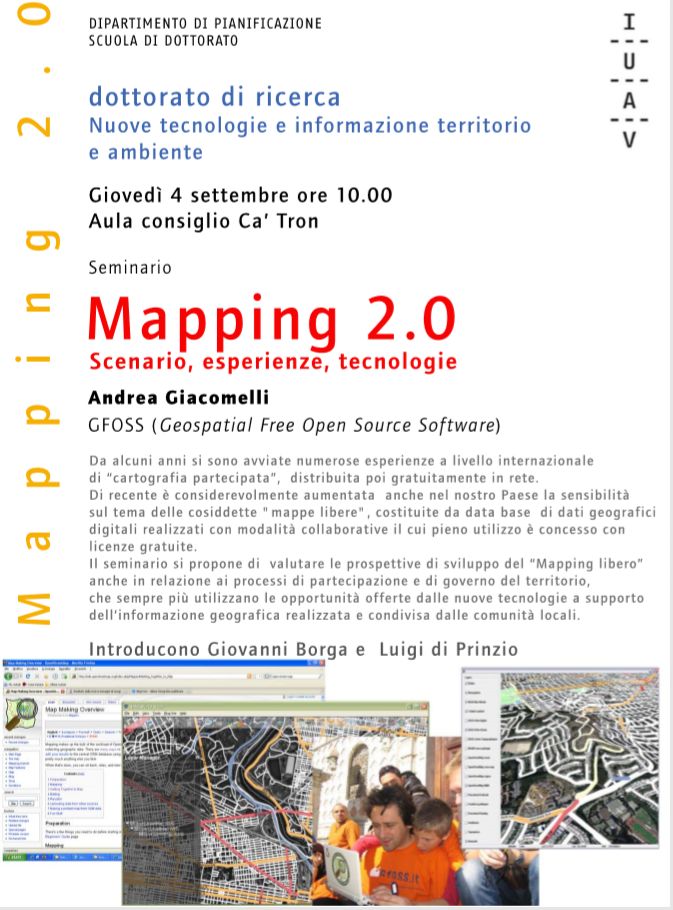
With a meeting organised at Politecnico di Milano, Faculty of Architecture.
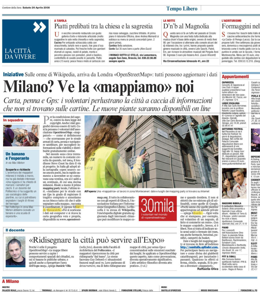
This is the presentation I gave in the final event for the m(‘)appare Milano project – a three month mapping campaign in the city of Milano, Italy, for which I proposed the concept, and managed together with folks from GFOSS.it the mapping events and media relations (including a local radio as a media partner).
NOTE: Since February 2010 I am not longer affiliated with GFOSS.it, so I have updated the presentation with my current contact information (and long live GFOSS.it).
[Apr. 25, 2020, revision with additional soundtrack: Just Dropped In]
…i..e. how to tell the right story in the wrong way..
At that time I was operating as the communications manager for the M(‘)appare Milano campaign, during my period with GFOSS.it, the Italian OSGEO Chapter. So I had to contact the author of this article to highlight a major omission, and a somewhat imbalanced presentation of the project actors. With all this said: forever kudos to EdoM. Namely:
Since all the information about the rationale and the development of the project were published through the GFOSS.it institutional site, it would not have been difficult to obtain additional information.
The author of the article was contacted about these issues. At the time she refused to consider the possibility of providing some sort of follow-up to give a more balanced picture. As a somewhat partial compensation to this partial representation, we ended up having the final campaign event hosted by Politecnico di Milano (July 2, 2008). Still, the story of mis-aligned perceptions related to m(‘)appare was far from being resolved. Several other months of interesting interactions followed (and, to som extent, are still ongoing).
For comments and information: info@pibinko.org. and http://www.pibinko.org/maps/