New interesting additions to the Farma Valley Community Map, with new place names and other background information provided by Scalvaia residents.
Thanks again to Remo Ganozzi for setting up the event:
Category Archives: Maps
Geomusic at GIT 2017 (Gavorrano, Southern Tuscany, June 12-13, 2017)
Our geomusical activity continues, after the launch at the Farma Valley Winter Fest (December 17, 18 and 19, 2016), the presentation at the FOSS4G conference in Genua (9-2-2017), the international webinar for Geo4all/ASPRS (7-4-2017) and the lecture at Politecnico di Milano (30-5-2017).
At the 12th conference of the Geomatics and Information Technologies section of the Italian Geology Society (aka: GIT 2017), held in Gavorrano, Southern Tuscany on June 12 and 13 2017 we presented:
- A poster called Participatory methods for territorial protection and promotion centered on a free/open source approach: case studies from Southern Tuscany( (by Andrea Giacomelli, Mario Straccali, Andrea Bartalucci, Claudio Spinosi)
- An oral presentation by Etruschi from Lakota’s, Dario Canal, on the subject of Participatory mapping in a geothermal area: first steps from the Cecina Valley.
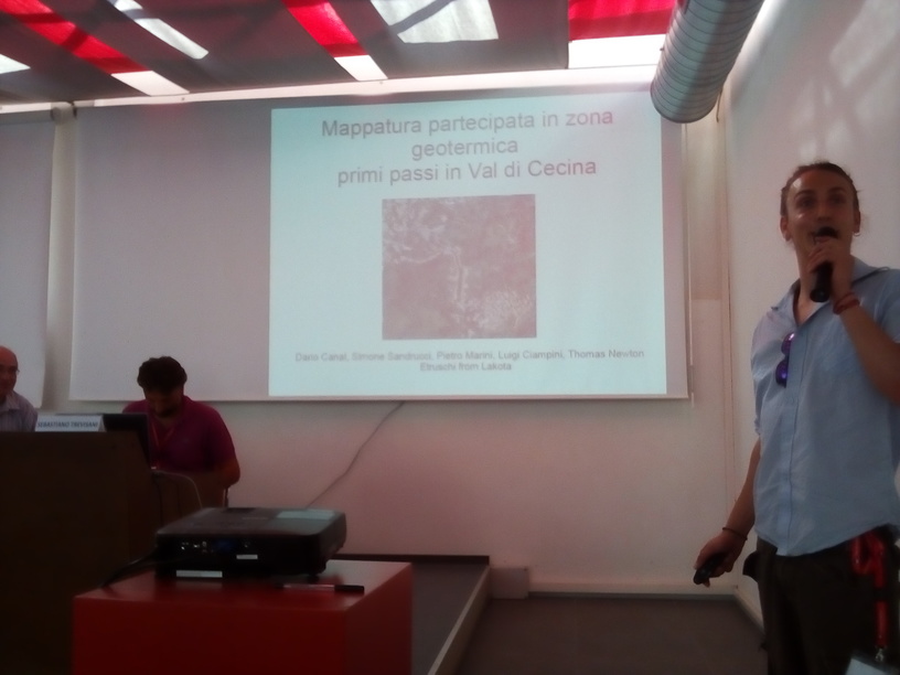
We don’t know of geologists going to contests for professional musicians…in our case we had a young professional musician and singer giving a talk in a geoscience conference (and kudos to Dario for taking up the challenge).
This was not a weird experiment, since we are collaborating with the band on on participatory mapping projects, and they are actually based in an area of great interest for geology (and geothermal activities), but surely it was an unusual and stimulating presentation.
Should you be interested in collaborating with the Val di Cecina participatory mapping campaign, which follows the work started in 2015 in the Farma Valley, please write to info@pibinko.org.
Politecnico di Milano, May 30, 2017: Interdisciplinary Land Protection and Planning (the flyer)
Having seen the very cool flyer prepared by CSBNO for the May 30 evening event, I felt the need to make it even with a flyer for the morning seminar at the Politecnico di Milano.
A presentation of both events is available: Politecnico (10.30AM) and Lucernate Civic Centre (9PM)
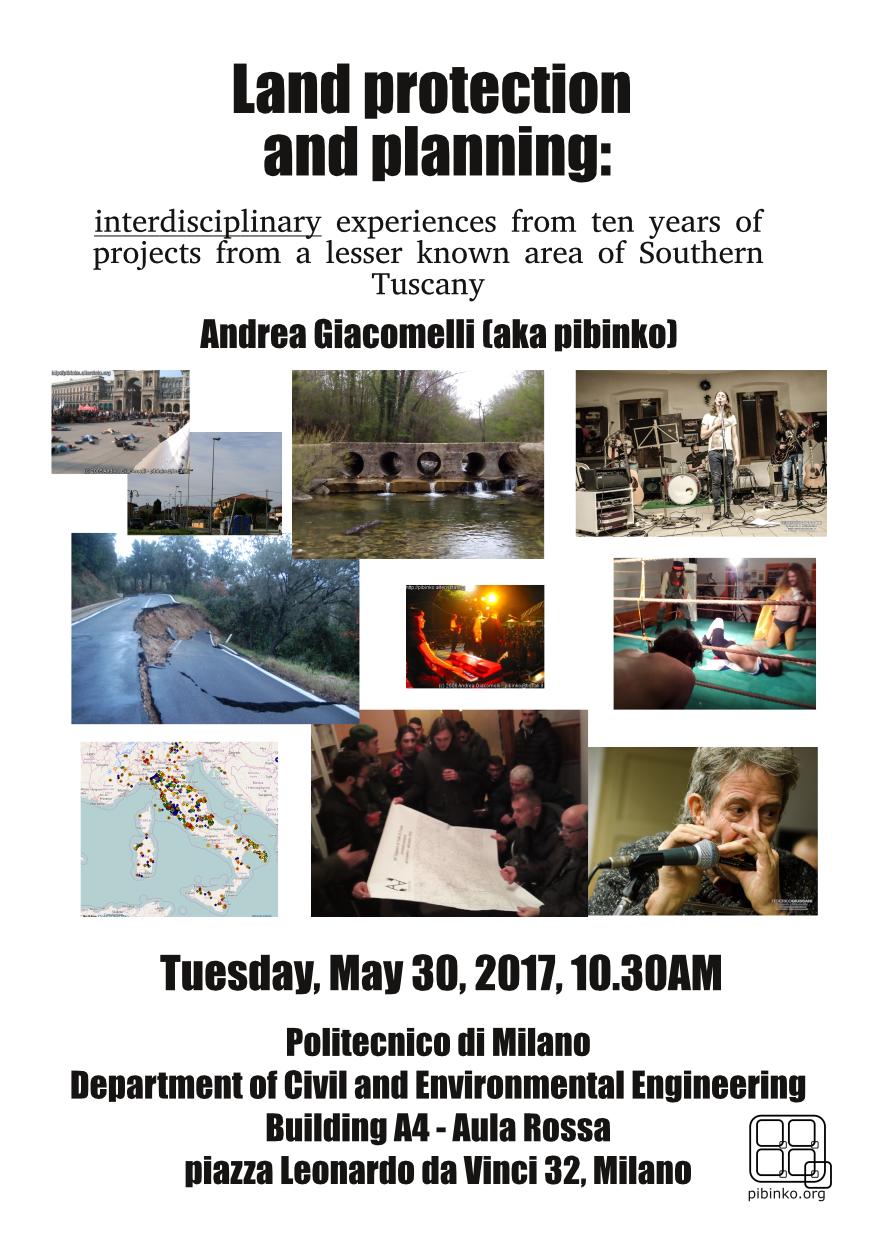
Politecnico di Milano, May 30, 2017: Land protection and planning: interdisciplinary experiences from ten years of projects from a lesser known area of Southern Tuscany.
![]() On May 30, at 10.30AM, I will give a lecture at the Politecnico di Milano (the third since 2011). We will meet in the Aula Rossa, building 4A of the Department of Civil and Environmental Engineering, campus Leonardo. If you can’t make it, I will be in town from May 29 to May 31st, and there will probably be another outreach event in the evening of May 30, so there will be options to meet.
On May 30, at 10.30AM, I will give a lecture at the Politecnico di Milano (the third since 2011). We will meet in the Aula Rossa, building 4A of the Department of Civil and Environmental Engineering, campus Leonardo. If you can’t make it, I will be in town from May 29 to May 31st, and there will probably be another outreach event in the evening of May 30, so there will be options to meet.
The presentation will provide highlights of a track record of projects started in 2006, where technicians and experts in geosciences and geotechnologies started a set of independent promotion and protection projects centered in a lesser know part of Southern Tuscany (the Farma Valley), including residents of the area in research and technology transfer projects.
These experiences were started in relation to little-known aspects of the region, not exactly at the core of environmental disciplines, such as ancient games, gradually making contact with topics which are more in the environmental engineering and land planning “mainstream”. This led the group to addressing renewable energy and energy efficiency, light pollution -with the peculiarity of the Farma Valley being at the centre of one of the darkest areas in Italy- optimization of alien species mitigation, environmental monitoring, and rural development.
The outcome of such an effort, which has not been made simple various factors, starting from the difficulty for many stakeholders to acknowledge the “out of the box” composition of the working group, has gradually showed and obtained recognition from different directions. From a research standpoint, we have activated collaborations on various EU-funded programs (FP7, COST and HORIZON2020), plus collaborations with Universities plus the Italian Research Council. Relevant results have also been obtained in the area of outreach and dissemination -with recurring coverage by national media- and education and training, with internships for various levels of students. Last but not least, these project have generated actual technology transfer and a positive socio-economic impact on the interested communities.
In addition to an overall summary of the projects, the presentation will outline the dissemination and citizen science program for the coming months, where it will be possible to participate both as tourists, possibly during the Summer season, but preferably as students or researchers, with the possibility of collaborating with ongoing activities and proposing new topics.
Andrea Giacomelli, MS in environmental engineering (Politecnico di Milano, 1993) and PhD in Hydrology (Politecnico di Milano, 1997), specialized in geographic information systems and environmental data management. He has 23 years of professional experience, spread across different sectors: university, applied research and technology transfer, consulting, and project management in corporate environments. Since 2011 he operates as a freelancer, based in Southern Tuscany. In 2006 he started a series of projects focused on the protection and promotion of lesser known resources in the fields of culture, environment, and open innovation, including a significant component of community engagement elements (participatory processes, events, communication) and a strong level of “contamination” with arts, collaborating also with photographers and musicians, including live events.
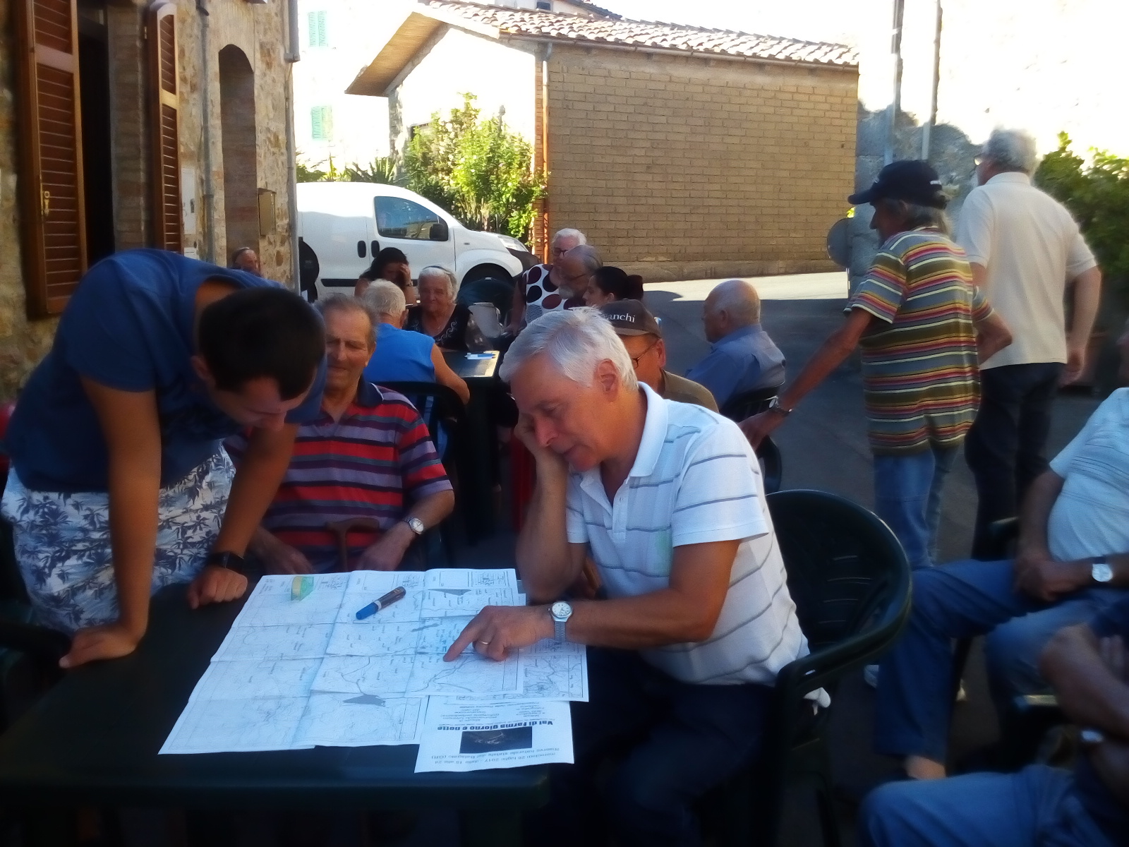
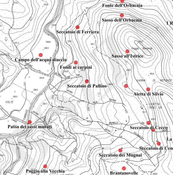
The first “hard copy” steps for the Farma Valley (Tuscany) community map
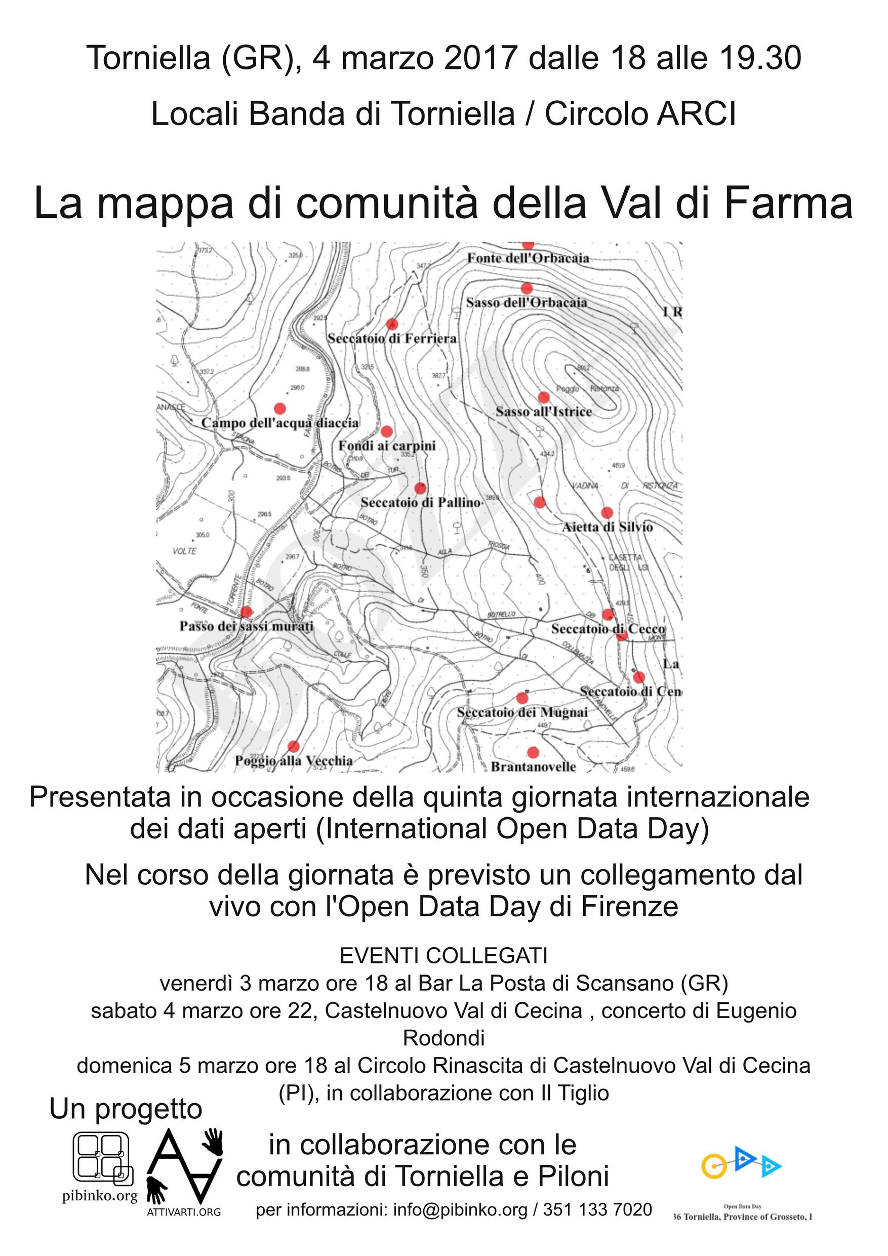 During the last International Open Data Day, on March 4, 2017, we presented the first draft copy of the Farma Valley community map, with two events in Scansano and Castelnuovo Val di Cecina as warm-up and debriefing events.
This map was the first result of an activity stated at the end of 2014, when we participated to the competition for location-based games launched by the INVOLEN EU research project. At that time we interviewed a group of residents from the hamlets of Torniella and Piloni, asking them do identfiy points of interest and place names which are no longer documented in the official base maps by the Regional government (you might want to read our article from the proceeding of the final INVOLEN conference to learn more about this: Integrating Culture, Environment, and Open Innovation for Awareness Raising: a Case from the Farma Valley, Tuscany).
The first round of the exercise led to recover 114 place names on an extension of approximately 8 square kilometers.
 Between March and April we then received an additional set of points of interest reported by the community of Scalvaia, on the Northern side of the valley, with 63 place names over approximately two square kilometers. These have been added to the preexisting points. In the meantime we made contact with other experts from Piloni, who will soon receive a copy of the base maps to provide their input on the area of Montalto, in the Southwestern part of the valley.
The data collected through December 2016 was published on the Regione Toscana Open Data Portal. Meanwhile, ideas were starting to take shape on different ways to deploy the map in the “physical” world. The opportunity arose a couple of weeks ago.
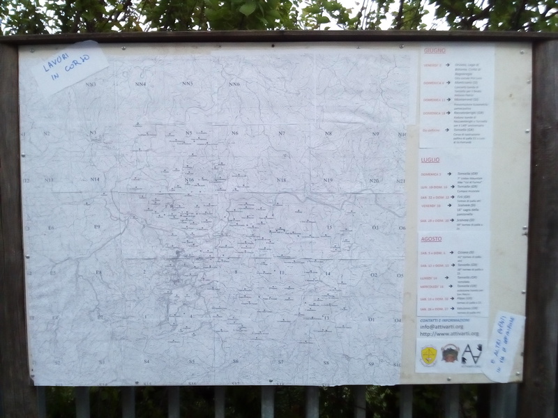
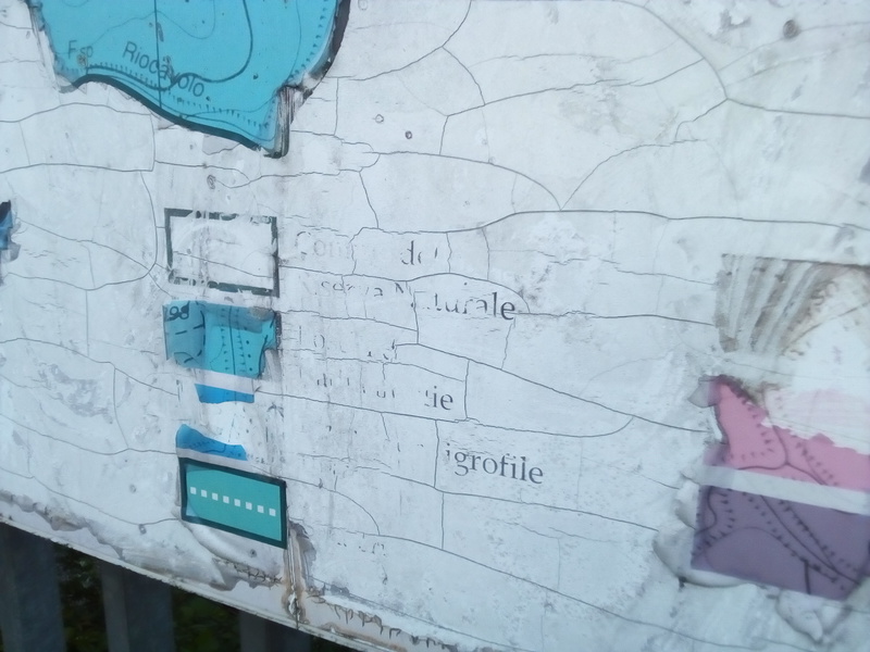 The Attivarti.org association inquired with the Municipality of Roccastrada (administering the hamlets of Torniella and Piloni) about the possibility of revamping a wooden billboard which was installed several years ago as a support for an information sheet concerning the “Pietra” natural reserve. The board was lacking maintenance and not really readable.
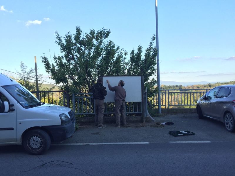
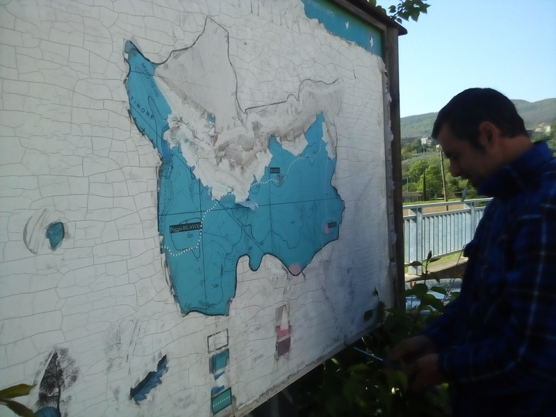 having received an OK to proceed by the Municipality, we recovered the support, cleaned up the vegetation which was gradually covering the installation, and used the renovated board as a base for version 2 of the community map, protected by a plexiglass sheet.
At present the new map has a “square” aspect ratio, so we considered using the remaining space to provide additional information on the Farma Valley and its activities.
As a start, we posted the calendar of events (as of April 29) for June, July, and August, covering initiatives involving the Piloni, Torniella, and Scalvaia communities, the Band of Torniella, Attivarti.org, BuioMetria Partecipativa, and other communities we interact with (such as the palla a 21/palla eh! tournaments). You may also check this calendar online on http://www.pibinko.org/calendar, where you will also find the past trail of events related to the community map, and other interesting projects.
Furthermore, we are in the process of editing information sheets about the valley and more detailed descriptions concerning the map.
 A peculiar aspect of the project concerns the materials and the assembly process. Since we expect to release frequent updates of the map and of the calendar during the Summer, all the graphics have been “spliced” to A4-size sheets. This will simplify -and make less expensive- subsequent edits (we found a few typos in the place names and will need to add new point batches), and will provide a form of live update on our initiatives for those who cannot follow us via internet, which are not few in the area.
 So: where are we with the community map? The residents are extremely interested in the heritage preservation aspect of the project, which higher-level official sources would find very hard to follow. This interest does not just originate from nostalgic emotions (although it is intriguing to record the narrations which are triggered by simply exposing the map to any native). In fact, the map is helping the locals to re-think (or for some to actually think)about potential initiatives to protect and promote the valley.
And what about the feedback by visitors? We will find out in the coming months, with the tourist season approaching. Even just yesterday, with the arrival of relations and friends for the upcoming First of May celebrations, several of them noted the map, where you can locate chestnut drying facilities, WW2 shelters, hunting points, water springs and other points of interest which you may get to know better if you will decide to explore the valley.
For the creation of the new billboard, in addition to thanking the Municipality of Roccastrada for allowing the use of the board, it is important to acknowledge the support by Andrea Bartalucci, Giorgio Panerati / Casa Bazar, Sara Canu and Bianca Costea.
For more information, comments, or proposals: info@pibinko.org
The recording of the webinar of open-source geomatics, environment and music from Southern Tuscany
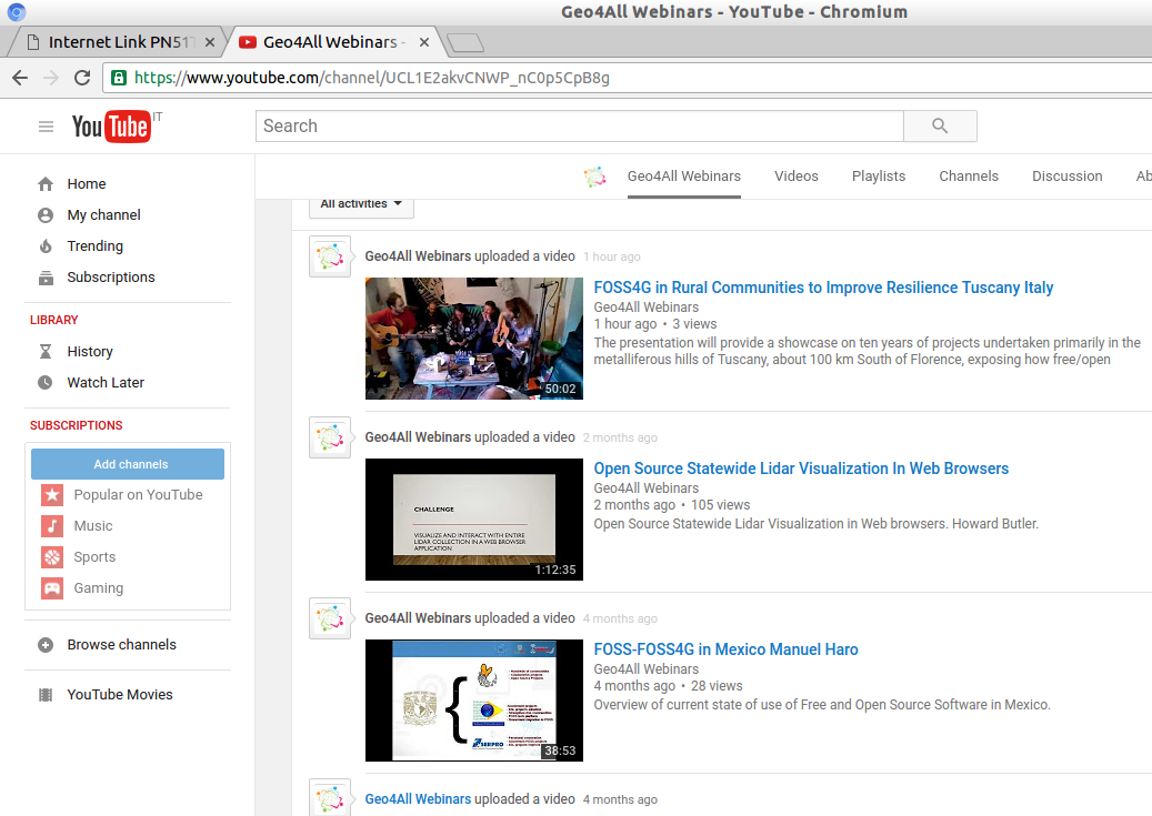 With a few days of delay due to minor technical issues, please see the recording of the April 7 webinar I gave together with Etruschi from Lakota on the subject of : “How Free/Open Source Geomatics can integrate in Rural Communities to improve Resilience and Quality of Life“.
The title came out somewhat convoluted, but the talk is definitely more linear. The video was published on the YouTube channel of the Geoforall Network, an international consortium of open-source geomatics labs (if you are not in the field: folks working with lots of multi-coloured maps on computers). With repect to the thumbnails of the videos from other webinars, you might note a difference: instead of the typical slide with a flowchart, or a map, or a bullet list, you see young rockers in action. This is in fact because the presentation, about 45 minutes overall, combines the talking part with a couple of songs performed live during the webinar, on topics related to rural issues, together with some short intervals when the topic was changing (allowing the main presenter to recover some stamina). An introduction to the webinar, providing some of the rationale is provided in a blog post from April 6.
Please enjoy, and let us know if you like the geomatics and music combination:
Thanks again to Geoforall (Rafael Moreno-Sanchez) and ASPRS (David Alvarez) for inviting us.
Save the date: Apr 7, 2017 webinar on “How Free/Open Source Geomatics can integrate in Rural Communities to improve Resilience and Quality of Life”
Between 6PM and 7PM CEST (Rome Time) on Friday April 7 pibinko, with the support of some colleagues, will be giving a webinar explaining “How Free/Open Source Geomatics can integrate in Rural Communities to improve Resilience and Quality of Life“. The event is kindly hosted by the American Society for Photogrammetry & Remote Sensing and promoted by the Open Source Geospatial Consortium’s Geo for all initative.
The presentation will provide a showcase on ten years of projects undertaken primarily in the Metalliferous Hills of Tuscany, about 100 km South of Florence, but very often with an international reach. The webinar will tell how free/open source geomatics -integrated with other skills- systematically helps to make our day and, with a little help from our friends (mainly, but not exclusively, residents), might also provide one of the assets to develop the area. Key highlights will be represented by initiatives related to ancient hand ball games (apparently disconnected from FOSS geomatics, but only apparently), light pollution, community maps, and biodiversity. We will also give some outlook on our plans for the current year, and make an invitation.
To attend the webinar, please register: https://attendee.gotowebinar.com/register/7696885240669077761
The presentation will be given by Andrea Giacomelli aka pibinko (www.pibinko.org):
- MS Environmental Engineering Politecnico di Milano, PhD Politecnico di Milano
- working with geographic information systems since 1993 and with free/open-source geomatics since 1994, being in the first generation of Italian users of GRASS. He is a documented contributor to Shapelib, and in 1998 was the author of the apr2html extension for ArcView (basically allowing a read- only but “open” access to ArcView projects).
- Working in numerous GIS projects applied to environment, tourism, industrial sites, utility management and more, dealing with all aspects of a system’s life cycle.
- In 2006-2007 he was part of the founding team for GFOSS.it, the Italian OSGEO Chapter, taking care of outreach and media relations through 2009. He then left the association and created in 2011 Attivarti.org, while in parallel working as pibinko.org
- In 2006 he started proposing his own projects related to protection and promotion of lesser known assets in the fields of culture, environment, and open innovation.
- Between 2010 and 2012 he acted as a facilitator for one of the working groups for the INSPIRE Directive data specifications.
- Since 2011 he runs his operations from two small villages in the hills of Southern Tuscany (Torniella and Tatti), travelling when necessary and often hosting projects and organizing events.
For more information: info@pibinko.org
Mar. 7, 2017: Mario Straccali on the Farma Valley Community Map
The Farma Valley (Southern Tuscany) Community Map
 The Farma Valley Community Map was created by using as a base map the current Tuscan administration official base maps (1:10000 scale), interviewing the elders of the three villages (Torniella, Piloni, and Scalvaia), in order to document points of interest and other information which does not exist in the official maps, but is relevant for the locals.
The toponyms thus produced are also published on the Regione Toscana Open Data Portal.
Following a first data base created in 2015, the work saw a second round of activity during the 2016-2017 Winter. In 2017 the map is undergoing several integrations and additions.
For more information: info@pibinko.org.
Please also refer to:
The article on the proceedings of the INVOLEN international conference on environmental education (Florence, Italy, Sep. 2015): Integrating Culture Environment and Open Innovation for Awareness Raising: a Case from the Farma Valley, Tuscany
and more posts from the pibinko.org blog:
http://www.pibinko.org/the-first-hard-copy-steps-for-the-farma-valley-tuscany-community-map/ for more recent updates
or write to info@pibinko.org for additional information.
Thank you
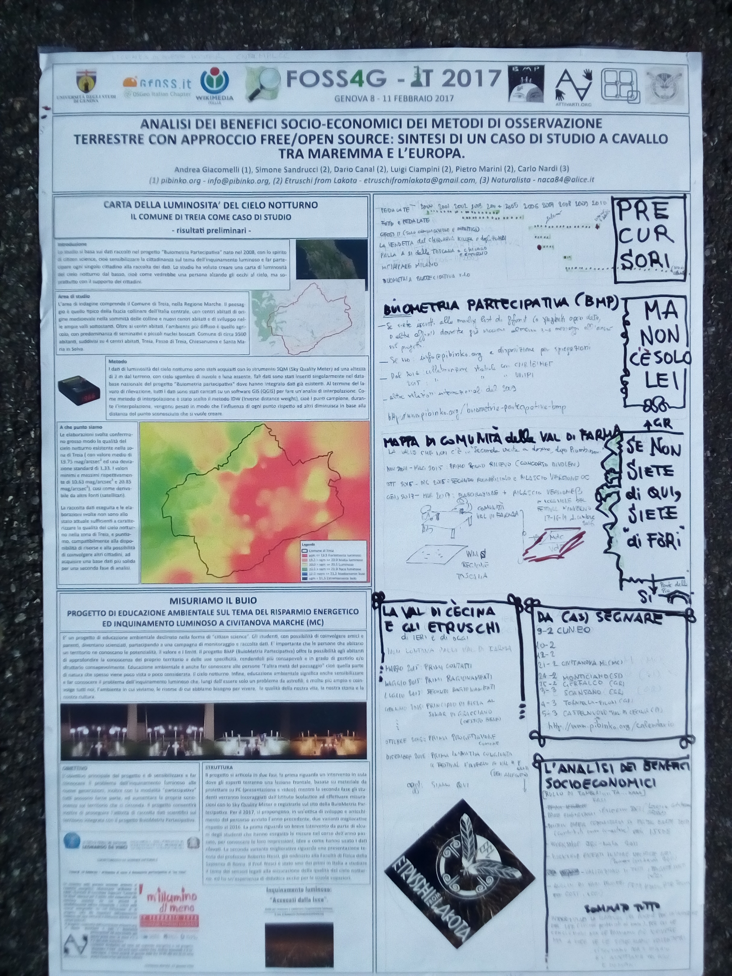
The poster presented at the FOSS4G-IT conference (Feb. 9-10, 2017)
The title of the poster is: Analysis of socio-economic benefits of Earth Observation methods with a free/open source approach: the Summary of case from Southern Tuscany to Europe. The right side of the poster was edited “live” prior to the poster session, in about an hour.
To see the full-size poster and read the details, click here. Also, you may want to check the presentation made by Etruschi from Lakota during the poster session.
The poster is in Italian. If you don’t read Italian and require specific clarifications, please let me know.