Save the date: March 4, 2017 – Farma Valley Open Data Day

In the afternoon of Saturday, March 4, the Farma Valley will host an event connected to the International Open Data Day. The actual location is currently being identified (among various spaces which we and other associations use in the area). More information will be disclosed during the coming days. Our international Open Data Day will … Continue reading Save the date: March 4, 2017 – Farma Valley Open Data Day
February’s impressions: the Italian Open Geodata Day (Rome)

On Feb. 27 2014, the second Italian open geodata day was held in Rome. The meeting organisers reported some 500 registered attendees. The event was arranged in a plenary session in the morning, and four parallel sessions in the afternoon. This was -if I am not mistaken- the second Open Geodata Day. Last year I … Continue reading February’s impressions: the Italian Open Geodata Day (Rome)

The pibinko.org Network on Culture, Environment, and Open Innovation: our Services (Feb. 2022)

Since 1994, across different Italian regions and internationally, we have developed a combination of technical, management and creative skills and have worked with an extremely diverse client base, as demonstrated by our project portfolio. In parallel, we have created a list of qualified suppliers and contractors, while personally providing quality control and project management: “pibinko” … Continue reading The pibinko.org Network on Culture, Environment, and Open Innovation: our Services (Feb. 2022)

Save the date: Apr 7, 2017 webinar on “How Free/Open Source Geomatics can integrate in Rural Communities to improve Resilience and Quality of Life”

Between 6PM and 7PM CEST (Rome Time) on Friday April 7 pibinko, with the support of some colleagues, will be giving a webinar explaining “How Free/Open Source Geomatics can integrate in Rural Communities to improve Resilience and Quality of Life“. The event is kindly hosted by the American Society for Photogrammetry & Remote Sensing and … Continue reading Save the date: Apr 7, 2017 webinar on “How Free/Open Source Geomatics can integrate in Rural Communities to improve Resilience and Quality of Life”

Mapping the affiliation of INSPIRE Annex 2 and 3 Data Specification experts

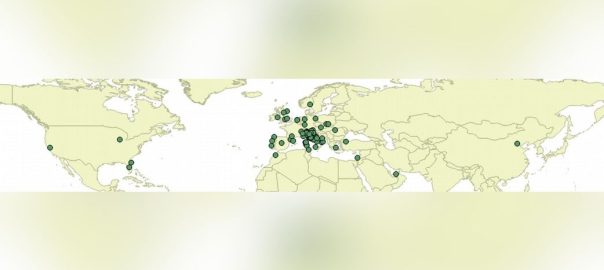
Between 2010 and 2012 about 200 experts from all over Europe provided their input to the definition of data specifications for the so called Annexes 2 and 3 of the INSPIRE Directive. The experts were divided in 19 groups, each referred to a theme (protected areas, atmospheric conditions, utilities, and so forth). Having worked as … Continue reading Mapping the affiliation of INSPIRE Annex 2 and 3 Data Specification experts

Opening of the 2014 buiometria partecipativa campaign at La Combriccola – Torniella

[TO BE TRANSLATED] L’incontro si è svolto dalle 14.30 alle 17 circa, presso il bar vineria La Combriccola di Torniella, frazione di Roccastrada (GR), nel versante sud della valle del Farma. Chi trovate fra le 14.30 e le 17 circa di un febbraio caldo e grigio nel versante sud della valle del Farma, con una … Continue reading Opening of the 2014 buiometria partecipativa campaign at La Combriccola – Torniella